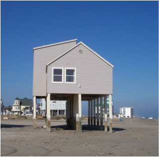
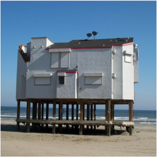
There is excitement associated with ownership of a piece of paradise. Ensure that you have a good understanding of all its associated costs, your personal risk tolerance, and insure your property adequately, so that you can continue to sleep at night and enjoy it for years to come.
Even if there hasn't been rain in
Federal Insurance Rate Maps (FIRM or digital: DFIRM) delineate flood hazard zones for coastal communities. Zones determine insurance rates, and home design. FIRM maps are used by your Banker, Designer and Builder, Municipality, Insurance Agent, Land Surveyor, and Engineer, all assisting with definition of a home’s position and elevation relative to the shoreline. |
Design Considerations |
Seaside Home Design provides residential design for those pursuing our alternative lifestyle; that of Life on the Coast! More often than not, clients are not familiar with the peculiarities of building on the island. Part of my calling entails educating prospective residents about building and construction issues unique to the island. I often consult with clients who are unfamiliar with the topic, so worth revisiting is the requirement for Flood and Windstorm Insurance in addition to conventional Homeowners' Insurance policy.
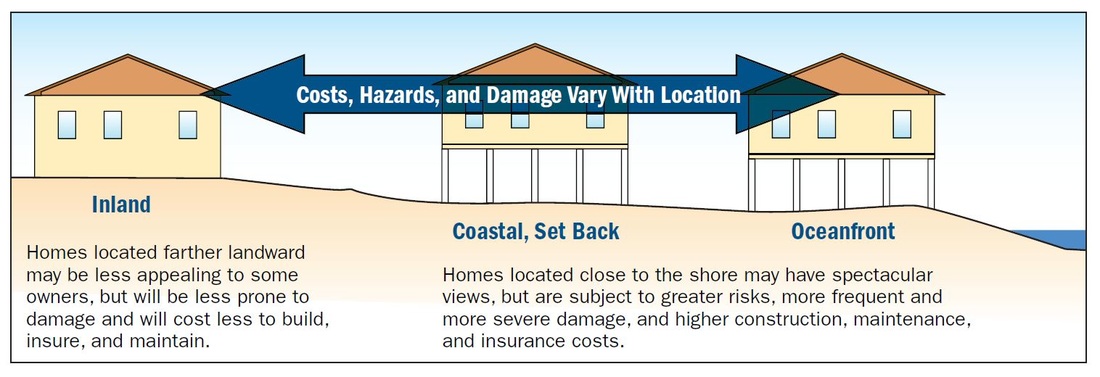
Whether buying or building, be aware that Galveston Island falls into FEMA Flood Hazard Zones, and is governed by Texas Department of Insurance for Windstorm coverage. Texas Homeowners Policies EXCLUDE flood loss, and federal grants are available only if the community is declared a disaster area by the President. Our lives here on the coast seem priceless most days of the year. Once or twice a year, when the insurance bill arrives, we wonder whether it is enough, or too much - coverage, not price! The appearance of a tropical storm in the gulf is another day we question our home's insurance coverage! By then it may be too late to change. Federal Insurance Rate Maps (FIRM or digital: DFIRM) delineate flood hazard zones for coastal communities. Zones determine insurance rates, and home design. FIRM maps are used by your Banker, Designer and Builder, Municipality, Insurance Agent, Land Surveyor, and Engineer, all assisting with definition of a home’s position and elevation relative to the shoreline and mean sea level. Flooding can occur inland, as we’ve seen in other counties and states. However, flood levels, velocity, and wave action in coastal areas tend to be more damaging than inland flooding. Homes in coastal areas must be designed and constructed to withstand higher wind loads and more extreme conditions, therefore, will cost more to design, build, repair, maintain, and insure, due to exposure to this environment. Engineering requirements, applicable to coastal flood and wind zones, assist in ensuring that construction and repairs are a success, and that a building resists damage over its lifetime. FEMA construction guidelines identify that flat or low-sloped roofs are subject to increased uplift, which can result in damage to interiors. In Galveston, flat roofed buildings demonstrated some of Ike's worst affects. Moderately sloping hip roofs are most desirable to combat this effect. |
